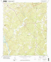
1971 Map of Kings Creek
USGS Topo · Published 1974About this map
Kings Creek and Smyrna anchor this 1970s landscape on the border of Cherokee and York Counties, where the industrial and agrarian histories of the South Carolina Upstate intersect. The Southern railroad line cuts a diagonal path through the terrain, serving local interests like the numerous claypits scattered near the tracks and the community at Kings Creek. The northeastern corner is dominated by the sprawling boundaries of Kings Mountain National Military Park and Kings Mountain State Park, preserving a significant portion of the ridge near Jefferson Mtn.
Find a feature on this map
44 named features on this map. Tap any name to fly to it.
Don’t see what you’re looking for? This feature index may not catch every label — zoom into the map to look around manually.
Map Details
Editions of this 1971 Kings Creek Map
3 editions found
Other maps of this area

1906 · Kings Mountain
USGS Topo · 1:62,500

1907 · Sharon
USGS Topo · 1:62,500

1908 · Kings Mountain
USGS Topo · 1:62,500

1909 · Gaffney
USGS Topo · 1:62,500

1941 · Spartanburg
USGS Topo · 1:250,000

1953 · Spartanburg
USGS Topo · 1:250,000

1953 · Charlotte
USGS Topo · 1:250,000

1954 · Charlotte
USGS Topo · 1:250,000

1960 · Charlotte
USGS Topo · 1:250,000

1960 · Spartanburg
USGS Topo · 1:250,000