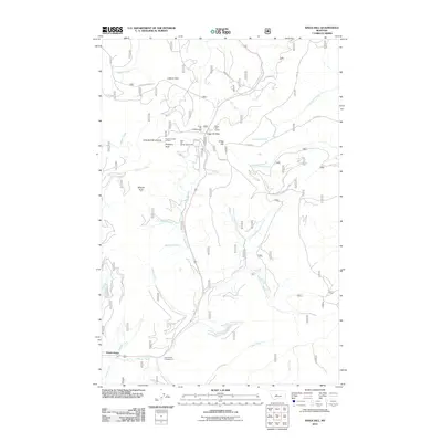
2011 Map of Kings Hill
USGS Topo · Published 2011About this map
Forest Green and the surrounding high-altitude terrain of the Little Belt Mountains define this section of central Montana. The map highlights a recreation-centered landscape, anchored by the King Hill Winter Sports Area and the high point of Porphyry Peak, where the Porphyry Peak Lookout stands watch. This area is a critical drainage divide, with Sheep Creek flowing south toward Forest Green and Belt Creek trending north. The transport corridor over Kings Hill Pass connects these watersheds, serving as a primary route through the National Forest. The land use pattern reflects a mix of preservation and extraction, from the Kings Hill Campground and Lamb Creek Campground to industrial points like the Kings Hill Quarry. Dozens of mountain drainages, including Mizpah Creek, Deadman Creek, and Cleveland Creek, carve the landscape, while named ridges like Log Spur Divide 4 indicate the historic and modern importance of forest management and topography in Meagher County.
Find a feature on this map
42 named features on this map. Tap any name to fly to it.
Don’t see what you’re looking for? This feature index may not catch every label — zoom into the map to look around manually.
Map Details
Editions of this 2011 Kings Hill Map
This is the sole edition of this map. No revisions or reprints were ever made.
Other maps of this area

1886 · Little Belt Mts.
USGS Topo · 1:250,000

1894 · Little Belt Mts.
USGS Topo · 1:250,000

1897 · Little Belt Mts.
USGS Topo · 1:250,000

1898 · Little Belt Mts.
USGS Topo · 1:250,000

1902 · Little Belt Mts.
USGS Topo · 1:250,000

1948 · White Sulphur Springs
USGS Topo · 1:250,000

1958 · White Sulphur Springs
USGS Topo · 1:250,000

1961 · White Sulphur Springs
USGS Topo · 1:250,000
1961 · Kings Hill
USGS Topo · 1:24,000
1961 · Neihart
USGS Topo · 1:24,000