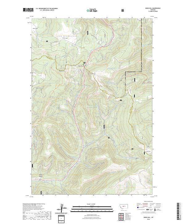
2024 Map of Kings Hill
USGS Topo · Published 2024About this map
Kings Hill Pass serves as a central point of orientation within the Lewis & Clark National Forest, where the high-altitude terrain of the Little Belt Mountains meets the triple-county intersection of Cascade, Meagher, and Judith Basin. This 2024 survey documents a landscape defined by prominent summits such as Porphyry Peak and Mizpah Peak, and the intricate drainage systems of Belt Creek and Sheep Creek. The map details a modern network of forest access, including the Lone Grave Atv Trl and Weatherwax Trl, illustrating how recreational infrastructure is integrated into the timber and meadowlands. Pockets of open space like Moose Park and O'Brien Park break the forested slopes, while the descriptive Warming Hut Knob hints at the area's use as a winter destination for those navigating the high mountain passes.
Find a feature on this map
54 named features on this map. Tap any name to fly to it.
Don’t see what you’re looking for? This feature index may not catch every label — zoom into the map to look around manually.
Map Details
Editions of this 2024 Kings Hill Map
This is the sole edition of this map. No revisions or reprints were ever made.
Other maps of this area

1886 · Little Belt Mts.
USGS Topo · 1:250,000

1894 · Little Belt Mts.
USGS Topo · 1:250,000

1897 · Little Belt Mts.
USGS Topo · 1:250,000

1898 · Little Belt Mts.
USGS Topo · 1:250,000

1902 · Little Belt Mts.
USGS Topo · 1:250,000

1948 · White Sulphur Springs
USGS Topo · 1:250,000

1958 · White Sulphur Springs
USGS Topo · 1:250,000

1961 · White Sulphur Springs
USGS Topo · 1:250,000
1961 · Kings Hill
USGS Topo · 1:24,000
1961 · Neihart
USGS Topo · 1:24,000