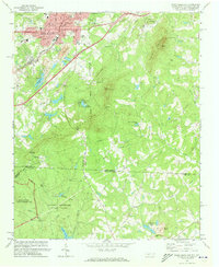
1971 Map of Kings Mountain
USGS Topo · Published 1973About this map
Kings Mountain and its surrounding peaks dominate this 1970s landscape, which straddles the border between North Carolina and South Carolina. The northern portion of the map is defined by the industrial and civic center of the city, where the Southern railroad line runs adjacent to the Quarry and various industrial waste ponds. Notable local landmarks like the Armory, City Hall, and the Central School highlight the community's mid-century footprint.
Find a feature on this map
65 named features on this map. Tap any name to fly to it.
Don’t see what you’re looking for? This feature index may not catch every label — zoom into the map to look around manually.
Map Details
Editions of this 1971 Kings Mountain Map
This is the sole edition of this map. No revisions or reprints were ever made.
Other maps of this area

1906 · Kings Mountain
USGS Topo · 1:62,500

1908 · Kings Mountain
USGS Topo · 1:62,500

1909 · Lincolnton
USGS Topo · 1:62,500

1911 · Lincolnton
USGS Topo · 1:62,500

1914 · Gastonia
USGS Topo · 1:48,000

1916 · Gastonia
USGS Topo · 1:62,500

1947 · Clover
USGS Topo · 1:62,500

1949 · Clover
USGS Topo · 1:62,500

1953 · Charlotte
USGS Topo · 1:250,000

1954 · Charlotte
USGS Topo · 1:250,000