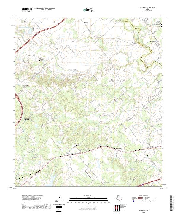
2022 Map of Kingsbury
USGS Topo · Published 2022About this map
Kingsbury sits at the southern edge of this Central Texas landscape, where the flatlands of the Post Oak Savannah meet the rolling Mill Creek Hills. The area is defined by a dense concentration of historical burial sites, including the Prairie Lea Masonic Cem and Sweet Canaan Cem, which speak to the long-standing community foundations in this region. Further north, the settlement of Prairie Lea occupies a bend in the San Marcos River, while Staples anchors the northwestern corner near the Caldwell Co and Guadalupe Co border. Aviation history is preserved at the Old Kingsbury Aerodrome, a facility known for its collection of vintage aircraft. The drainage patterns of York Cr and Brushy Cr illustrate the local topography that once guided early ranching and agricultural development in these rural reaches east of Seguin.
Find a feature on this map
81 named features on this map. Tap any name to fly to it.
Don’t see what you’re looking for? This feature index may not catch every label — zoom into the map to look around manually.
Map Details
Editions of this 2022 Kingsbury Map
This is the sole edition of this map. No revisions or reprints were ever made.
Other maps of this area

1911 · San Marcos
USGS Topo · 1:125,000

1919 · San Marcos
USGS Topo · 1:125,000

1924 · San Marcos 3-c
USGS Topo · 1:48,000

1924 · San Marcos 3-d
USGS Topo · 1:48,000

1925 · San Marcos 4-c
USGS Topo · 1:48,000

1929 · Luling
USGS Topo · 1:62,500

1930 · Lockhart
USGS Topo · 1:62,500

1930 · Seguin
USGS Topo · 1:62,500

1953 · Seguin
USGS Topo · 1:250,000

1958 · Seguin
USGS Topo · 1:250,000