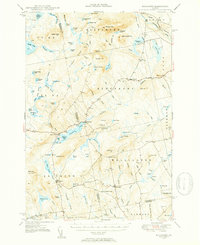
1948 Map of Kingsbury
USGS Topo · Published 1953About this map
The town of Kingsbury and the high ridges of the Piscataquis and Somerset county border define this post-war landscape. The terrain is marked by a complex network of glacial features, from the deep waters of Kingsbury Pond and Austin Pond to the extensive wetlands of Kingsley Bog and Baker Flowage. Settled clearings are scattered primarily along the valley roads, connecting small clusters like Mayfield Corner and Brighton.
Find a feature on this map
107 named features on this map. Tap any name to fly to it.
Don’t see what you’re looking for? This feature index may not catch every label — zoom into the map to look around manually.
Map Details
Editions of this 1948 Kingsbury Map
3 editions found

Other maps of this area

1903 · Bingham
USGS Topo · 1:62,500

1904 · Anson
USGS Topo · 1:62,500

1905 · Bingham
USGS Topo · 1:62,500

1905 · The Forks
USGS Topo · 1:62,500

1907 · The Forks
USGS Topo · 1:62,500

1913 · Skowhegan
USGS Topo · 1:62,500

1930 · Pittsfield
USGS Topo · 1:48,000

1932 · Pittsfield
USGS Topo · 1:62,500

1933 · Pittsfield
USGS Topo · 1:62,500

1933 · Guilford
USGS Topo · 1:62,500