
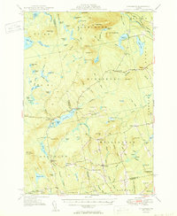
1950 Map of Kingsbury
USGS Topo · Published 1950About this map
Kingsbury Pond sits at the heart of this Maine landscape, serving as a focal point for the small settlements and crossroads that define the region. In the mid-century, the area remained a network of rural hamlets, many identified by family-named junctions such as Mayfield Corner, Burdin Corner, and Huff Corner. The map reveals a community structured around its topography and local institutions, featuring the Campbell Sch and several small burial grounds including Foss Hill Cem and Taylor Cem. The terrain is characterized by numerous water bodies like Austin Pond and Whetstone Pond, alongside prominent heights such as Bald Mountain and Kelly Mtn, the latter of which features a Lookout Tower. This survey captures the transition from a wilderness economy toward a more established rural infrastructure, evidenced by the scattered bogs, flowages, and the presence of the Piscataquis River in the northeast corner.
Find a feature on this map
114 named features on this map. Tap any name to fly to it.
Don’t see what you’re looking for? This feature index may not catch every label — zoom into the map to look around manually.
Map Details
Editions of this 1950 Kingsbury Map
2 editions found
Other maps of this area

1903 · Bingham
USGS Topo · 1:62,500

1904 · Anson
USGS Topo · 1:62,500

1905 · Bingham
USGS Topo · 1:62,500

1905 · The Forks
USGS Topo · 1:62,500

1907 · The Forks
USGS Topo · 1:62,500

1913 · Skowhegan
USGS Topo · 1:62,500

1930 · Pittsfield
USGS Topo · 1:48,000

1932 · Pittsfield
USGS Topo · 1:62,500

1933 · Pittsfield
USGS Topo · 1:62,500

1933 · Guilford
USGS Topo · 1:62,500