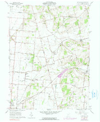
1961 Map of Kingscreek
USGS Topo · Published 1990About this map
The Ohio Caverns and surrounding agricultural lands of Logan and Champaign Counties are documented in this 1961 survey. The landscape is characterized by its organized road network, with routes such as Mennonite Church Road and Kanaga Road connecting family-named cemeteries and rural intersections. The local economy is represented by several Gravel Pits and the expansive State Game Farm south of Kennard.
Find a feature on this map
55 named features on this map. Tap any name to fly to it.
Don’t see what you’re looking for? This feature index may not catch every label — zoom into the map to look around manually.
Map Details
Editions of this 1961 Kingscreek Map
Other maps of this area

1913 · Bellefontaine
USGS Topo · 1:48,000

1913 · East Liberty
USGS Topo · 1:62,500

1914 · St. Paris
USGS Topo · 1:62,500

1914 · Mechanicsburg
USGS Topo · 1:62,500

1915 · Bellefontaine
USGS Topo · 1:62,500

1915 · East Liberty
USGS Topo · 1:62,500

1916 · Mechanicsburg
USGS Topo · 1:62,500

1916 · St. Paris
USGS Topo · 1:62,500

1944 · East Liberty
USGS Topo · 1:62,500

1944 · Mechanicsburg
USGS Topo · 1:62,500