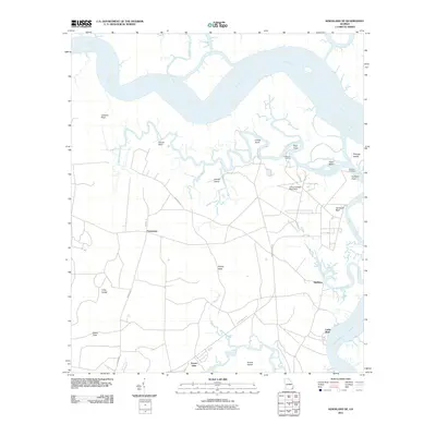
2011 Map of Kingsland NE
USGS Topo · Published 2011About this map
The Satilla River dominates the northern reaches of this coastal Georgia landscape, its wide channel snaking toward the Atlantic past landmarks like Lookout Point and Crews Point. This terrain is a complex network of marshes and winding waterways, including Todd Creek and Shellbine Creek, which frame significant landmasses such as Floyds Neck and African Island. The settlement pattern is sparse, centered on small communities like Shellbine and Forestview, and more isolated coastal sites like Cabin Bluff along the Cumberland River.
Find a feature on this map
33 named features on this map. Tap any name to fly to it.
Don’t see what you’re looking for? This feature index may not catch every label — zoom into the map to look around manually.
Map Details
Editions of this 2011 Kingsland NE Map
This is the sole edition of this map. No revisions or reprints were ever made.
Other maps of this area

1918 · Cumberland Island
USGS Topo · 1:62,500

1918 · Bladen
USGS Topo · 1:62,500

1918 · Kingsland
USGS Topo · 1:62,500

1930 · Cumberland Island
USGS Topo · 1:62,500

1939 · Bladen
USGS Topo · 1:62,500

1945 · Brunswick
USGS Topo · 1:62,500

1945 · Cumberland Island
USGS Topo · 1:62,500

1946 · Brunswick
USGS Topo · 1:250,000

1948 · Jacksonville
USGS Topo · 1:250,000

1948 · Brunswick
USGS Topo · 1:250,000