
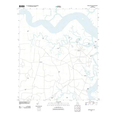
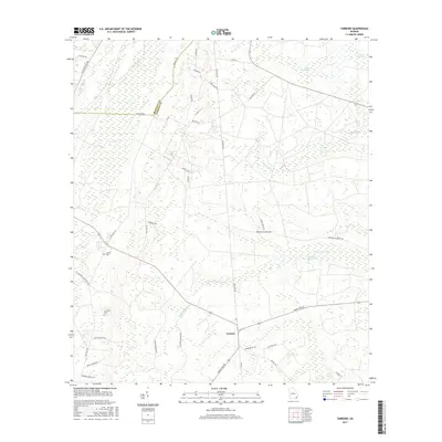
1979 Map of Kingsland NE
USGS Topo · Published 1980About this map
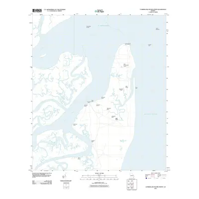
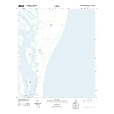
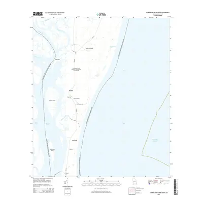
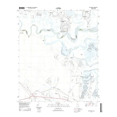
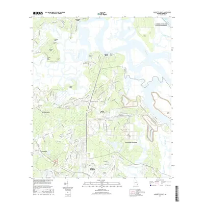
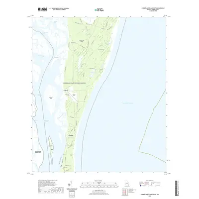
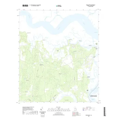
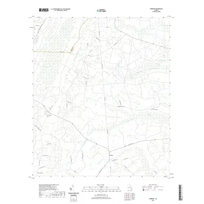
Satilla River tides and complex marshland drainage dominate this coastal Georgia landscape, where the Cumberland River meets the Intracoastal Waterway. The terrain is a intricate network of named swamps and cuts, including Barrell Head Swamp and Bailey Cut, which define the low-lying geography of Floyds Neck. This 1970s orthophotomap provides a clear view of the transition between the dense vegetation of African Island and the open waters of Crow Harbor Reach. Local human presence is marked by isolated sites such as the Fairfield Cem and the settlement at Forestview. Navigation and land use are indicated by features like the Schooner Landing and a Landing Strip, while the eastern edge transition into the Cumberland Island National Seashore reflects the area's conservation importance during the late twentieth century.
Find a feature on this map
51 named features on this map. Tap any name to fly to it.
Don’t see what you’re looking for? This feature index may not catch every label — zoom into the map to look around manually.
Map Details
Editions of this 1979 Kingsland NE Map
This is the sole edition of this map. No revisions or reprints were ever made.
Historical Maps of Grover View Through Time
68 maps found

1917 Boulogne
Camden County, GA

1918 Cumberland Island
Camden County, GA

1919 Boulogne
Camden County, GA

1930 Cumberland Island
Camden County, GA

1945 Cumberland Island
Camden County, GA

1958 Cumberland Island North
Camden County, GA

1958 Cumberland Island South
Camden County, GA

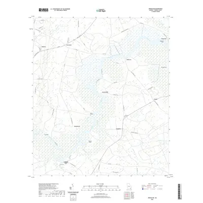
1958 Harrietts Bluff
Camden County, GA

1958 Kingsland NE
Camden County, GA

1961 Dover Bluff
Camden County, GA

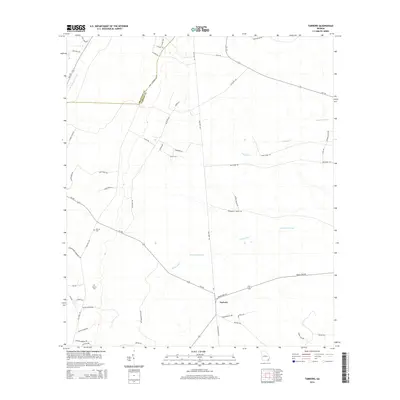
1975 Tarboro
Camden County, GA

1978 Jerusalem
Camden County, GA

1978 Tarboro
Camden County, GA

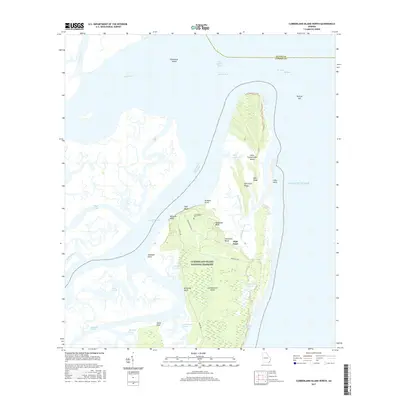
1979 Cumberland Island North
Camden County, GA

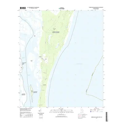
1979 Cumberland Island South
Camden County, GA

1979 Dover Bluff
Camden County, GA
1979 Kingsland NE
Camden County, GA

1979 St Marys
Camden County, GA

1980 Harrietts Bluff
Camden County, GA

1993 Cumberland Island North
Camden County, GA

1993 Dover Bluff
Camden County, GA

1993 Jerusalem
Camden County, GA

1993 Kingsland NE
Camden County, GA

1993 St Marys
Camden County, GA

1993 Tarboro
Camden County, GA

1994 Cumberland Island South
Camden County, GA

1994 Harrietts Bluff
Camden County, GA

1998 Cumberland Island North
Camden County, GA
2011 Cumberland Island North
Camden County, GA
2011 Cumberland Island South
Camden County, GA

2011 Dover Bluff
Camden County, GA
2011 Harrietts Bluff
Camden County, GA
2011 Jerusalem
Camden County, GA
2011 Kingsland NE
Camden County, GA
2011 Saint Marys
Camden County, GA
2011 Tarboro
Camden County, GA
2014 Cumberland Island North
Camden County, GA
2014 Cumberland Island South
Camden County, GA

2014 Dover Bluff
Camden County, GA
2014 Harrietts Bluff
Camden County, GA
2014 Jerusalem
Camden County, GA
2014 Kingsland NE
Camden County, GA
2014 Saint Marys
Camden County, GA
2014 Tarboro
Camden County, GA
2017 Cumberland Island North
Camden County, GA
2017 Cumberland Island South
Camden County, GA

2017 Dover Bluff
Camden County, GA
2017 Harrietts Bluff
Camden County, GA
2017 Jerusalem
Camden County, GA
2017 Kingsland NE
Camden County, GA
2017 Saint Marys
Camden County, GA
2017 Tarboro
Camden County, GA

2020 Cumberland Island North
Camden County, GA
2020 Cumberland Island South
Camden County, GA

2020 Dover Bluff
Camden County, GA

2020 Harrietts Bluff
Camden County, GA
2020 Jerusalem
Camden County, GA
2020 Kingsland NE
Camden County, GA

2020 Saint Marys
Camden County, GA
2020 Tarboro
Camden County, GA

2024 Cumberland Island North
Camden County, GA

2024 Cumberland Island South
Camden County, GA

2024 Dover Bluff
Camden County, GA

2024 Harrietts Bluff
Camden County, GA

2024 Jerusalem
Camden County, GA

2024 Kingsland NE
Camden County, GA

2024 Saint Marys
Camden County, GA

2024 Tarboro
Camden County, GA