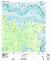
1993 Map of Kingsland NE
USGS Topo · Published 1995About this map
Satilla River tides wind through the maritime wetlands and pine barrens of Camden County in this late-twentieth-century study. The map documents the intricate hydrography of Floyds Neck, an area defined by deep-water cuts and extensive marsh complexes like Copeland Swamp and Hermitage Swamp. Local history is anchored by family-named landmarks such as Cabin Bluff and Fairfield Point, where the Fairfield Cem and Floyd Cem are located.
Find a feature on this map
53 named features on this map. Tap any name to fly to it.
Don’t see what you’re looking for? This feature index may not catch every label — zoom into the map to look around manually.
Map Details
Editions of this 1993 Kingsland NE Map
This is the sole edition of this map. No revisions or reprints were ever made.
Other maps of this area

1918 · Cumberland Island
USGS Topo · 1:62,500

1918 · Bladen
USGS Topo · 1:62,500

1918 · Kingsland
USGS Topo · 1:62,500

1930 · Cumberland Island
USGS Topo · 1:62,500

1939 · Bladen
USGS Topo · 1:62,500

1945 · Brunswick
USGS Topo · 1:62,500

1945 · Cumberland Island
USGS Topo · 1:62,500

1946 · Brunswick
USGS Topo · 1:250,000

1948 · Jacksonville
USGS Topo · 1:250,000

1948 · Brunswick
USGS Topo · 1:250,000