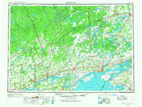
1954 Map of Kingston
USGS Topo · Published 1968About this map
Kingston and the surrounding borderlands of the St. Lawrence River anchor this mid-century regional study. The landscape is defined by the complex aquatic geography of the Bay of Quinte and the southern reaches of the Canadian Shield, where dozens of water bodies like Rideau Lake and Mazinaw Lake interrupt the terrain. The transition from the agricultural lowlands near Belleville to the higher elevations of Mt. Moriah reflects the varied economic activities of the era, from lakeside tourism in the St. Lawrence Islands National Park to the industrial rail hubs of the Canadian National and Canadian Pacific lines.
Find a feature on this map
81 named features on this map. Tap any name to fly to it.
Don’t see what you’re looking for? This feature index may not catch every label — zoom into the map to look around manually.
Map Details
Editions of this 1954 Kingston Map
4 editions found
Other maps of this area

1893 · Sackets Harbor
USGS Topo · 1:62,500

1895 · Sacketts Harbor
USGS Topo · 1:62,500

1895 · Stony Island
USGS Topo · 1:62,500

1895 · Watertown
USGS Topo · 1:62,500

1895 · Cape Vincent
USGS Topo · 1:62,500

1898 · Watertown
USGS Topo · 1:62,500

1900 · Clayton
USGS Topo · 1:62,500

1903 · Grindstone
USGS Topo · 1:62,500

1903 · Clayton
USGS Topo · 1:62,500

1903 · Alexandria Bay
USGS Topo · 1:62,500