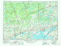
1954 Map of Kingston
USGS Topo · Published 1981About this map
Kingston and the eastern reaches of Lake Ontario anchor this mid-century cross-border survey, illustrating the deep maritime and rail connections between Ontario and Jefferson County, New York. The landscape is defined by the labyrinthine waterways of the Bay of Quinte and the St. Lawrence River, where the international boundary threads through the Thousand Islands. Industrial and transportation hubs like Belleville, Trenton, and Deseronto are shown alongside the Tyendinaga Ind. Res., marking a period of significant postwar infrastructure development. The map meticulously records the extensive rail networks of the era, including the Canadian National RR and Canadian Pacific RR on the north shore, and the New York Central RR serving Cape Vincent and Clayton on the American side.
Find a feature on this map
300 named features on this map. Tap any name to fly to it.
Don’t see what you’re looking for? This feature index may not catch every label — zoom into the map to look around manually.
Map Details
Editions of this 1954 Kingston Map
4 editions found
Other maps of this area

1893 · Sackets Harbor
USGS Topo · 1:62,500

1895 · Sacketts Harbor
USGS Topo · 1:62,500

1895 · Stony Island
USGS Topo · 1:62,500

1895 · Watertown
USGS Topo · 1:62,500

1895 · Cape Vincent
USGS Topo · 1:62,500

1898 · Watertown
USGS Topo · 1:62,500

1900 · Clayton
USGS Topo · 1:62,500

1903 · Grindstone
USGS Topo · 1:62,500

1903 · Clayton
USGS Topo · 1:62,500

1903 · Alexandria Bay
USGS Topo · 1:62,500