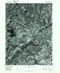
1976 Map of Kingston
USGS Topo · Published 1979About this map
The Kingston area and the broad valley of the Susquehanna River are captured here in late 1976. This orthophotoquad provides an unvarnished photographic perspective of the dense residential and industrial patterns in the Wyoming Valley during the mid-seventies, showing the close-knit development of boroughs like Edwardsville, Swoyersville, and Larksville. Unlike a standard topographic map, the photographic detail allows for a clear distinction between the urban grid of the river towns and the higher-elevation landscapes near Dallas. The reservoir and surrounding agricultural tracts near Huntsville stand out in the western portion of the sheet, illustrating the transition from the river's edge into the rural outskirts of Luzerne County. This era reflects the established post-war footprint of these communities just before further modern suburban expansion modified the woodlots and fields surrounding the older coal-country settlements.
Find a feature on this map
7 named features on this map. Tap any name to fly to it.
Don’t see what you’re looking for? This feature index may not catch every label — zoom into the map to look around manually.
Map Details
Editions of this 1976 Kingston Map
This is the sole edition of this map. No revisions or reprints were ever made.
Other maps of this area

1891 · Wilkesbarre
USGS Topo · 1:62,500

1891 · Harveys Lake
USGS Topo · 1:62,500

1893 · Harvey Lake
USGS Topo · 1:62,500

1893 · Pittston
USGS Topo · 1:62,500

1894 · Shickshinny
USGS Topo · 1:62,500

1894 · Wilkesbarre
USGS Topo · 1:62,500

1943 · Scranton
USGS Topo · 1:125,000

1946 · Nanticoke
USGS Topo · 1:31,680

1946 · Kingston
USGS Topo · 1:24,000

1946 · Harveys Lake
USGS Topo · 1:24,000