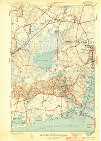
1944 Map of Kingston
USGS Topo · Published 1944About this map
The Rhode Island State College campus dominates the northeastern landscape of this mid-century survey, just as the local coastal economy begins to transition toward its modern form. Along the shore of Block Island Sound, the twin fishing villages of Jerusalem and Galilee sit on opposite sides of the Breachway, while the bustling centers of Wakefield and Peace Dale show a dense network of residential streets and early industrial sites. Inland, the vast Great Swamp remains largely untamed, preserved by its difficult terrain and marked by the Great Swamp Fight Site. The New York New Haven and Hartford railroad cuts a straight line through this wilderness, connecting West Kingston to the wider region. From the many coastal ponds like Potter Pond to the heights of Tefft Hill, the map captures the distinct character of South Kingstown before extensive post-war suburban development altered the rural and maritime balance.
Find a feature on this map
116 named features on this map. Tap any name to fly to it.
Don’t see what you’re looking for? This feature index may not catch every label — zoom into the map to look around manually.
Map Details
Editions of this 1944 Kingston Map
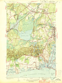
2 editions found
Other maps of this area

1889 · Charlestown
USGS Topo · 1:62,500

1889 · Newport
USGS Topo · 1:62,500

1890 · Narragansett Bay
USGS Topo · 1:62,500

1890 · Kent
USGS Topo · 1:62,500

1892 · Narragansett Bay
USGS Topo · 1:62,500

1894 · Kent
USGS Topo · 1:62,500

1894 · Newport
USGS Topo · 1:62,500

1904 · Newport
USGS Topo · 1:62,500

1919 · Charlestown
USGS Topo · 1:62,500

1919 · Narragansett Bay
USGS Topo · 1:62,500