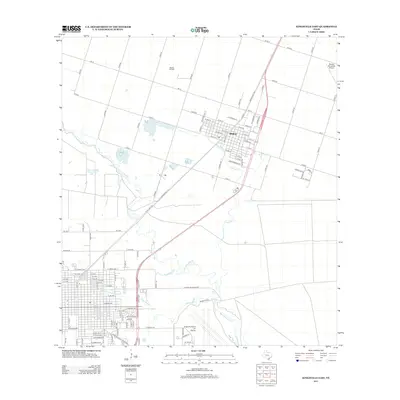
2013 Map of Kingsville East
USGS Topo · Published 2013About this map
Kingsville Naval Air Station dominates the southern landscape of this coastal bend region, appearing here with its complex of runways and perimeter infrastructure during the early twenty-first century. To the north, the city of Bishop serves as a hub for both agricultural and industrial activity, anchored by the nearby Bishop Oil Field and Bishop Municipal Airport. The terrain is defined by a series of intermittent drainages and natural features, including San Fernando Cr, Carreta Cr, and the Tranquitas Cr system which winds toward the naval facility. A distinctive landmark, the Caesar Grande Water Hole, reflects the traditional ranching heritage of Kleberg and Nueces counties. The map also traces a dense network of farm-to-market roads and county routes, such as FM-70 and State Loop 428, illustrating the modern transportation corridors that connect these South Texas communities.
Find a feature on this map
105 named features on this map. Tap any name to fly to it.
Don’t see what you’re looking for? This feature index may not catch every label — zoom into the map to look around manually.
Map Details
Editions of this 2013 Kingsville East Map
This is the sole edition of this map. No revisions or reprints were ever made.
Other maps of this area

1924 · Petronilla
USGS Topo · 1:62,500

1928 · Sarita
USGS Topo · 1:125,000

1950 · Corpus Christi
USGS Topo · 1:250,000

1952 · Riviera Beach NW
USGS Topo · 1:24,000

1952 · Riviera Beach
USGS Topo · 1:62,500

1954 · Kingsville
USGS Topo · 1:62,500

1954 · Petronila
USGS Topo · 1:62,500

1954 · Riviera
USGS Topo · 1:62,500

1956 · Corpus Christi
USGS Topo · 1:250,000

1960 · Corpus Christi
USGS Topo · 1:250,000