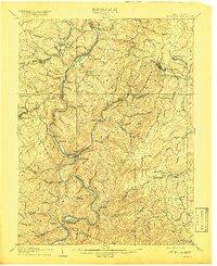
1907 Map of Kingwood
USGS Topo · Published 1918About this map
The Cheat River carves a deep, winding path through the Briery Mountains and Laurel Ridge in this early 20th-century survey of Preston County. The landscape is defined by its early transit network, where established routes like the Morgantown Turnpike and the Northwestern Virginia Turnpike intersect with the critical Baltimore and Ohio RR corridor. Along the river, historical crossing points such as Fairfax Ferry, Trowbridge Ferry, and the Pleasant Valley Ford indicate how commerce and residents moved before the widespread construction of modern bridges.
Find a feature on this map
91 named features on this map. Tap any name to fly to it.
Don’t see what you’re looking for? This feature index may not catch every label — zoom into the map to look around manually.
Map Details
Editions of this 1907 Kingwood Map
2 editions found
Other maps of this area

1886 · St. George
USGS Topo · 1:125,000

1891 · St. George
USGS Topo · 1:125,000

1895 · Piedmont
USGS Topo · 1:125,000

1899 · Oakland
USGS Topo · 1:62,500

1900 · Accident
USGS Topo · 1:62,500

1900 · Oakland
USGS Topo · 1:62,500

1902 · Morgantown
USGS Topo · 1:62,500

1904 · Bruceton
USGS Topo · 1:62,500

1907 · Thornton
USGS Topo · 1:62,500

1907 · Kingwood
USGS Topo · 1:62,500