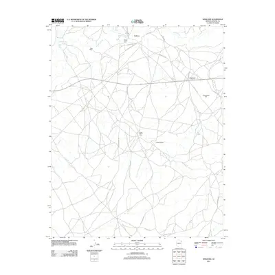
2011 Map of Kinlichee
USGS Topo · Published 2011About this map
Kinlichee Creek meanders through this landscape of the Fort Defiance Agency, providing the primary hydrological backbone for a region defined by scattered community hubs and seasonal washes. The settlement of Kinlichee serves as a focal point, anchored by the Kinlichee Chapter House and the Kinlichee School, reflecting the civic and educational infrastructure of the area. To the south, the Cross Canyon area is marked by the Cross Canyon Trading Post, a classic waypoint for commerce and local interaction.
Find a feature on this map
24 named features on this map. Tap any name to fly to it.
Don’t see what you’re looking for? This feature index may not catch every label — zoom into the map to look around manually.
Map Details
Editions of this 2011 Kinlichee Map
This is the sole edition of this map. No revisions or reprints were ever made.
Other maps of this area

1886 · Fort Defiance
USGS Topo · 1:250,000

1892 · Fort Defiance
USGS Topo · 1:250,000

1954 · Gallup
USGS Topo · 1:250,000

1955 · Zith-Tusayan Butte 3 NW
USGS Topo · 1:24,000

1955 · Zith-Tusayan Butte 2 SE
USGS Topo · 1:24,000

1955 · Zith-Tusayan Butte 2 SW
USGS Topo · 1:24,000

1955 · Zith-Tusayan Butte 3 NE
USGS Topo · 1:24,000
1955 · Nazlini
USGS Topo · 1:62,500

1958 · Gallup
USGS Topo · 1:250,000

1959 · Gallup
USGS Topo · 1:250,000