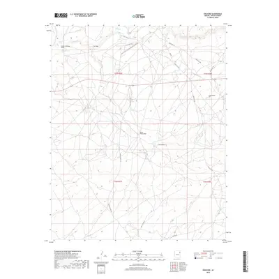
2018 Map of Kinlichee
USGS Topo · Published 2018About this map
Pueblo Colorado Valley serves as a primary geographic anchor in this high-desert landscape of the Fort Defiance Agency. The 2018 survey reveals a network of tribal routes and local connectors that navigate the drainage systems of the Colorado Plateau, including Pueblo Colorado Wash and Kinlichee Cr. A notable intersection of local infrastructure and community history is found at Kinlichee Boarding School Rd, which branches off Indian Rte 39 to serve the northern reaches of the quadrangle.
Find a feature on this map
23 named features on this map. Tap any name to fly to it.
Don’t see what you’re looking for? This feature index may not catch every label — zoom into the map to look around manually.
Map Details
Editions of this 2018 Kinlichee Map
This is the sole edition of this map. No revisions or reprints were ever made.
Other maps of this area

1886 · Fort Defiance
USGS Topo · 1:250,000

1892 · Fort Defiance
USGS Topo · 1:250,000

1954 · Gallup
USGS Topo · 1:250,000

1955 · Zith-Tusayan Butte 3 NW
USGS Topo · 1:24,000

1955 · Zith-Tusayan Butte 2 SE
USGS Topo · 1:24,000

1955 · Zith-Tusayan Butte 2 SW
USGS Topo · 1:24,000

1955 · Zith-Tusayan Butte 3 NE
USGS Topo · 1:24,000
1955 · Nazlini
USGS Topo · 1:62,500

1958 · Gallup
USGS Topo · 1:250,000

1959 · Gallup
USGS Topo · 1:250,000