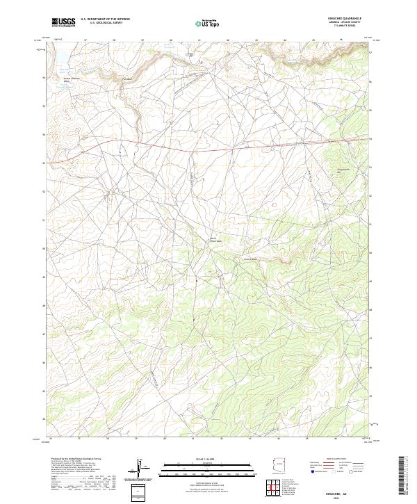
2021 Map of Kinlichee
USGS Topo · Published 2021About this map
Kinlichee and the surrounding high desert of the Navajo Nation are defined by a complex network of seasonal drainages and local roads that support a dispersed rural community. The landscape is carved by the Kinlichee Cr and the Pueblo Colorado Wash, which flow through the Pueblo Colorado Valley. This survey captures the modern infrastructure connecting the area, including State Hwy 264 and several Bureau of Indian Affairs routes like Indian Rte 39. Notable landmarks such as Choyojdolid Hill and Be-ite-Lini Spring provide geographic anchors for researchers of the Apache County region. The presence of the Kinlichee Boarding School Rd and Standing Chimney Rd indicates the intersection of traditional land use with institutional development in this portion of the Southwest.
Find a feature on this map
25 named features on this map. Tap any name to fly to it.
Don’t see what you’re looking for? This feature index may not catch every label — zoom into the map to look around manually.
Map Details
Editions of this 2021 Kinlichee Map
This is the sole edition of this map. No revisions or reprints were ever made.
Other maps of this area

1886 · Fort Defiance
USGS Topo · 1:250,000

1892 · Fort Defiance
USGS Topo · 1:250,000

1954 · Gallup
USGS Topo · 1:250,000

1955 · Zith-Tusayan Butte 3 NW
USGS Topo · 1:24,000

1955 · Zith-Tusayan Butte 2 SE
USGS Topo · 1:24,000

1955 · Zith-Tusayan Butte 2 SW
USGS Topo · 1:24,000

1955 · Zith-Tusayan Butte 3 NE
USGS Topo · 1:24,000
1955 · Nazlini
USGS Topo · 1:62,500

1958 · Gallup
USGS Topo · 1:250,000

1959 · Gallup
USGS Topo · 1:250,000