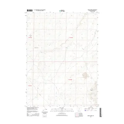
2015 Map of Kinney Spring
USGS Topo · Published 2015About this map
Adobe Town Rim dominates the southeastern portion of this 2015 high-desert survey in Sweetwater County. The landscape is defined by its drainage systems and ephemeral water sources, with Shell Cr winding through the center of the quadrangle. As a critical water point in this arid environment, Kinney Spring serves as a central landmark alongside the seasonal flows of Kinney Cr. The infrastructure consists primarily of Bureau of Land Management routes, such as Blm-4409 and Blm-4412, which provide access to the remote terrain. Topographical features like Eagle Nest Draw and Iron Pipe Draw reveal the erosive forces shaping the region's draws and flats, offering a detailed view of the Public Land Survey System divisions between T15N and T16N.
Find a feature on this map
13 named features on this map. Tap any name to fly to it.
Don’t see what you’re looking for? This feature index may not catch every label — zoom into the map to look around manually.
Map Details
Editions of this 2015 Kinney Spring Map
This is the sole edition of this map. No revisions or reprints were ever made.
Other maps of this area

1954 · Rock Springs
USGS Topo · 1:250,000

1958 · Rock Springs
USGS Topo · 1:250,000

1962 · Rock Springs
USGS Topo · 1:250,000

1968 · Chicken Creek East
USGS Topo · 1:24,000

1968 · Sand Butte Rim SE
USGS Topo · 1:24,000
1968 · Antelope Flats
USGS Topo · 1:24,000

1970 · Cow Creek Reservoir
USGS Topo · 1:24,000
1970 · Kinney Spring
USGS Topo · 1:24,000

1970 · Manuel Gap
USGS Topo · 1:24,000
1970 · Monument Valley
USGS Topo · 1:24,000