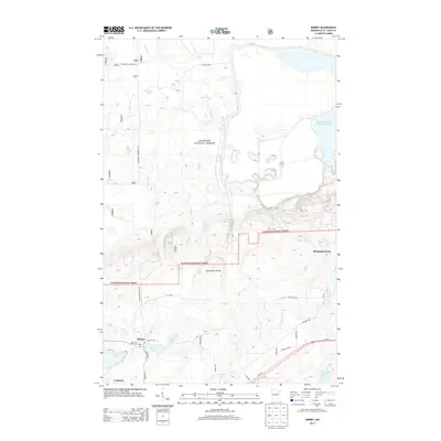
2013 Map of Kinney
USGS Topo · Published 2013About this map
The Laurentian Divide cuts across this section of the Mesabi Iron Range, marking the high ground where water flows either toward the Hudson Bay or the Atlantic Ocean. In this mineral-rich landscape of Saint Louis County, industrial and natural interests coexist. Large-scale mining operations, represented by the US Steel facility and the massive Minntac Tailings Basin Cell One, dominate the eastern and southern portions of the terrain.
Find a feature on this map
32 named features on this map. Tap any name to fly to it.
Don’t see what you’re looking for? This feature index may not catch every label — zoom into the map to look around manually.
Map Details
Editions of this 2013 Kinney Map
This is the sole edition of this map. No revisions or reprints were ever made.
Other maps of this area

1951 · Eveleth
USGS Topo · 1:24,000

1951 · Virginia
USGS Topo · 1:24,000

1951 · Kinney
USGS Topo · 1:24,000

1951 · Kirk
USGS Topo · 1:24,000

1951 · Britt
USGS Topo · 1:24,000

1951 · Buhl
USGS Topo · 1:24,000

1952 · Idington
USGS Topo · 1:24,000

1954 · Hibbing
USGS Topo · 1:250,000

1955 · Dark Lake
USGS Topo · 1:24,000

1955 · Dewey Lake SE
USGS Topo · 1:24,000