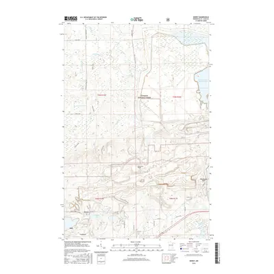
2016 Map of Kinney
USGS Topo · Published 2016About this map
The Laurentian Divide cuts through this portion of the Mesabi Range, a geographical marker where water begins its separate journeys toward the Hudson Bay or the Great Lakes. This industrial and natural landscape is centered around the mining communities of Kinney and Buhl, where the influence of U S Steel is evident in the sprawling infrastructure and large-scale water management projects like the Minntac Tailings Basin Cell One. To the north, the terrain transitions into the dense woods of the Superior National Forest, drained by the Dark River and the E Br Sturgeon River. Local transportation is defined by a network of specialized routes, including the Kinney Spur and Streetcar Rd, which speak to the area's legacy of moving both minerals and men between the pits and the settlements of Lucknow and Mountain Iron.
Find a feature on this map
38 named features on this map. Tap any name to fly to it.
Don’t see what you’re looking for? This feature index may not catch every label — zoom into the map to look around manually.
Map Details
Editions of this 2016 Kinney Map
This is the sole edition of this map. No revisions or reprints were ever made.
Other maps of this area

1951 · Eveleth
USGS Topo · 1:24,000

1951 · Virginia
USGS Topo · 1:24,000

1951 · Kinney
USGS Topo · 1:24,000

1951 · Kirk
USGS Topo · 1:24,000

1951 · Britt
USGS Topo · 1:24,000

1951 · Buhl
USGS Topo · 1:24,000

1952 · Idington
USGS Topo · 1:24,000

1954 · Hibbing
USGS Topo · 1:250,000

1955 · Dark Lake
USGS Topo · 1:24,000

1955 · Dewey Lake SE
USGS Topo · 1:24,000