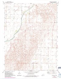
1972 Map of Kinsley SW
USGS Topo · Published 1984About this map
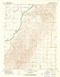
The Old Indian Treaty Boundary cuts a definitive line across this Edwards County landscape, marking a historical division south of the Arkansas River. This 1970s survey captures a transition in Kansas land use, where established holdings like Lewis Ranch and Charlet Ranch sit amidst the undulating terrain of North Brown and South Brown. The influence of the river system is evident in the path of Coon Creek and the township lines of Trenton and Kinsley. A notable piece of transportation history is preserved in the Old Railroad Grade that strikes across the eastern sections. Genealogists and local historians will find value in the specific placement of a local Cem and numerous wells that supported the agricultural operations of this plains region.
Find a feature on this map
12 named features on this map. Tap any name to fly to it.
Don’t see what you’re looking for? This feature index may not catch every label — zoom into the map to look around manually.
Map Details
Editions of this 1972 Kinsley SW Map
2 editions found
Other maps of this area

1889 · Kinsley
USGS Topo · 1:125,000

1892 · Kinsley
USGS Topo · 1:125,000

1892 · Spearville
USGS Topo · 1:125,000

1894 · Spearville
USGS Topo · 1:125,000

1894 · Kinsley
USGS Topo · 1:125,000

1955 · Pratt
USGS Topo · 1:250,000

1959 · Pratt
USGS Topo · 1:250,000

1969 · Bucklin NE
USGS Topo · 1:24,000

1969 · Greensburg NW
USGS Topo · 1:24,000
1969 · Greensburg NE
USGS Topo · 1:24,000