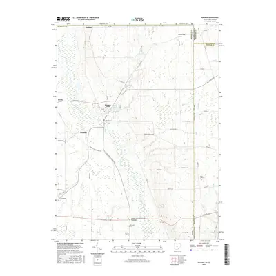
2016 Map of Kinsman
USGS Topo · Published 2016About this map
Kinsman sits at the heart of this Northeast Ohio landscape, where the waters of Pymatuning Creek and Stratton Cr converge near Kinsman Lake. The layout of the region is defined by a traditional grid of rural roads, including Main St and the Youngstown Conneaut Rd, which link the primary settlement with outlying communities like Farmdale and Vernon. These local transit corridors follow the natural topography shaped by smaller waterways such as Sugar Cr and Maple Cr. Genealogists will find significant value in the distribution of local burial grounds, including the New Kinsman Cem near the town center, and more remote sites like Rocky Ridge Cem to the east and Giddings Cem near the southern border. The map also captures the precise intersection of the Ohio-Pennsylvania state line, showing how local roads like Ray State Line Rd straddle the boundary between Trumbull, Crawford, and Mercer counties.
Find a feature on this map
74 named features on this map. Tap any name to fly to it.
Don’t see what you’re looking for? This feature index may not catch every label — zoom into the map to look around manually.
Map Details
Editions of this 2016 Kinsman Map
This is the sole edition of this map. No revisions or reprints were ever made.
Other maps of this area

1905 · Andover
USGS Topo · 1:48,000

1906 · Linesville
USGS Topo · 1:62,500

1907 · Andover
USGS Topo · 1:62,500

1907 · Kinsman
USGS Topo · 1:62,500

1908 · Shenango
USGS Topo · 1:62,500

1908 · Linesville
USGS Topo · 1:62,500

1950 · Cleveland
USGS Topo · 1:250,000

1956 · Cleveland
USGS Topo · 1:250,000

1958 · Sharpsville
USGS Topo · 1:24,000

1958 · Greensville West
USGS Topo · 1:24,000