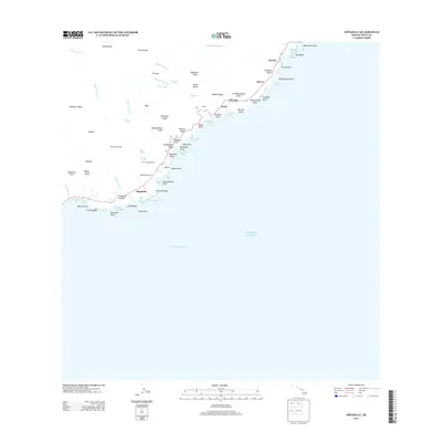
2013 Map of Kipahulu
USGS Topo · Published 2013About this map
Kipahulu and the surrounding coastline of Southeast Maui are defined by a series of dramatic gulches and waterfalls that empty into the Pacific Ocean. This coastal landscape is home to significant cultural sites like Kanekaula Heiau, reflecting the deep historical roots of the area. The settlement pattern follows the 31 corridor, connecting small communities such as Koali, Mu'olea, and Pu'uiki against the backdrop of the massive Kipahulu Valley.
Find a feature on this map
80 named features on this map. Tap any name to fly to it.
Don’t see what you’re looking for? This feature index may not catch every label — zoom into the map to look around manually.
Map Details
Editions of this 2013 Kipahulu Map
This is the sole edition of this map. No revisions or reprints were ever made.
Other maps of this area

1954 · Maui
USGS Topo · 1:250,000

1957 · Kipahulu
USGS Topo · 1:24,000

1957 · Hana
USGS Topo · 1:24,000

1957 · Nahiku
USGS Topo · 1:24,000

1957 · Kaupo
USGS Topo · 1:24,000

1966 · Maui
USGS Topo · 1:250,000

1974 · Maui
USGS Topo · 1:250,000

1978 · Hana
USGS Topo · 1:24,000

1983 · Nahiku
USGS Topo · 1:24,000
1983 · Kaupo
USGS Topo · 1:24,000