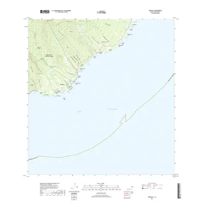
2017 Map of Kipahulu
USGS Topo · Published 2017About this map
Kipahulu anchors the southeastern coast of Maui, where the land drops sharply from the high ridges of Haleakala National Park to the Pacific Ocean. This coastal landscape is defined by its dramatic verticality, carved by numerous gulches such as 'Ohe'o Gulch and Wai'ele'ele Gulch. The hydrology of the region is a central feature, with notable landmarks like the Seven Pools and a series of significant waterfalls, including Wailua Falls, Waimoku Falls, and Makahiku Falls, that feed the narrow streams flowing toward the sea.
Find a feature on this map
77 named features on this map. Tap any name to fly to it.
Don’t see what you’re looking for? This feature index may not catch every label — zoom into the map to look around manually.
Map Details
Editions of this 2017 Kipahulu Map
This is the sole edition of this map. No revisions or reprints were ever made.
Other maps of this area

1954 · Maui
USGS Topo · 1:250,000

1957 · Kipahulu
USGS Topo · 1:24,000

1957 · Hana
USGS Topo · 1:24,000

1957 · Nahiku
USGS Topo · 1:24,000

1957 · Kaupo
USGS Topo · 1:24,000

1966 · Maui
USGS Topo · 1:250,000

1974 · Maui
USGS Topo · 1:250,000

1978 · Hana
USGS Topo · 1:24,000

1983 · Nahiku
USGS Topo · 1:24,000
1983 · Kaupo
USGS Topo · 1:24,000