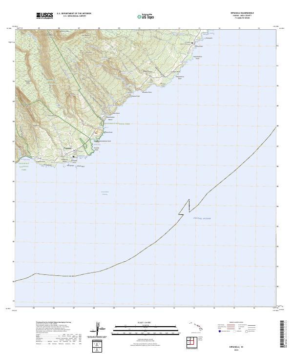
2024 Map of Kipahulu
USGS Topo · Published 2024About this map
Kipahulu remains a focal point of coastal Maui where the deep ravines of the Haleakalā National Park meet the Pacific Ocean. This modern topographic survey highlights a landscape dominated by dramatic water features and vertical relief, including the famous Pools of 'Ohe'o and the towering Waimoku Falls. Significant local history is preserved at the Palapala Ho'omau Church Cem and Saint Peters Catholic Church Cem, marking long-standing community roots along the windward coast.
Find a feature on this map
81 named features on this map. Tap any name to fly to it.
Don’t see what you’re looking for? This feature index may not catch every label — zoom into the map to look around manually.
Map Details
Editions of this 2024 Kipahulu Map
This is the sole edition of this map. No revisions or reprints were ever made.
Other maps of this area

1954 · Maui
USGS Topo · 1:250,000

1957 · Kipahulu
USGS Topo · 1:24,000

1957 · Hana
USGS Topo · 1:24,000

1957 · Nahiku
USGS Topo · 1:24,000

1957 · Kaupo
USGS Topo · 1:24,000

1966 · Maui
USGS Topo · 1:250,000

1974 · Maui
USGS Topo · 1:250,000

1978 · Hana
USGS Topo · 1:24,000

1983 · Nahiku
USGS Topo · 1:24,000
1983 · Kaupo
USGS Topo · 1:24,000