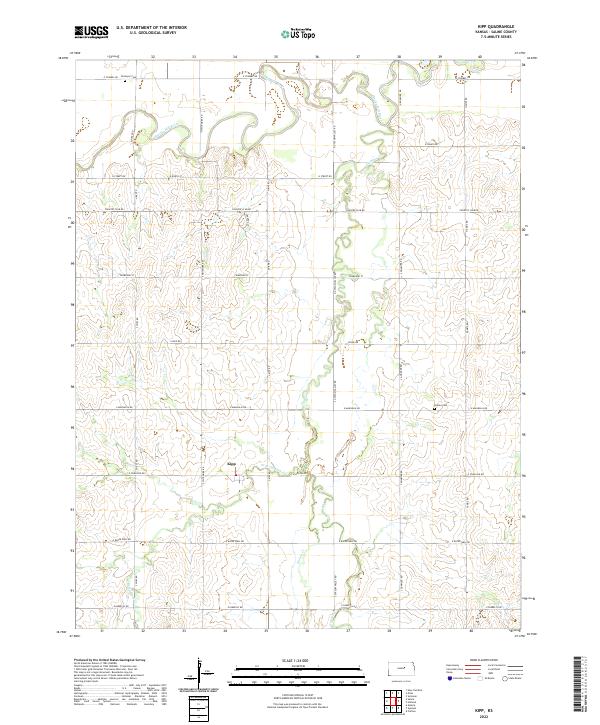
2022 Map of Kipp
USGS Topo · Published 2022About this map
Smoky Hill River winds across the northern landscape of this Saline County quadrangle, defining a fertile valley characterized by shifting oxbows and deep meandering channels. The small settlement of Kipp sits central to a grid of rural roads, serving as a focal point for the surrounding agricultural community. This area is defined by the drainage systems of Gypsum Cr and its tributaries, including W Br Gypsum Cr and Spring Cr, which carve through the terrain as they flow toward the main river. Historical markers of the region's early families are preserved at Donmyer Cem in the north and Poheta Cem to the east. The map reflects a stable rural infrastructure where modern county routes like N Gypsum Valley Rd and S Donmyer Rd follow long-established sections of the Kansas prairie.
Find a feature on this map
38 named features on this map. Tap any name to fly to it.
Don’t see what you’re looking for? This feature index may not catch every label — zoom into the map to look around manually.
Map Details
Editions of this 2022 Kipp Map
This is the sole edition of this map. No revisions or reprints were ever made.
Other maps of this area

1889 · Abilene
USGS Topo · 1:125,000

1892 · Salina
USGS Topo · 1:125,000

1894 · Abilene
USGS Topo · 1:125,000

1942 · Salina
USGS Topo · 1:125,000

1955 · Salina
USGS Topo · 1:24,000

1955 · Assaria
USGS Topo · 1:24,000

1955 · Niles
USGS Topo · 1:24,000

1955 · New Cambria
USGS Topo · 1:24,000

1955 · Kipp
USGS Topo · 1:24,000

1955 · Gypsum
USGS Topo · 1:24,000