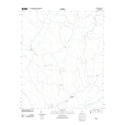
2011 Map of Kirk
USGS Topo · Published 2011About this map
Speeds Water Mill stands along the upper reaches of Bear Creek in this northern Pickens County landscape, illustrating a persistent connection between the region's watercourses and its early industrial history. The area is defined by a network of named roads like Kenny Hill School Rd and Union Church Rd that suggest the former locations of community hubs. To the south, Pleasant Grove and the Pleasant Grove Lookout Tower mark the high ground between Jones Creek and Box Creek, while the Sipsey River meanders across the southeastern corner. Genealogists will find significant value in the distribution of family-named landmarks and burial grounds, including Mitchell Cemetery, Liberty Cemetery, and Union Cemetery. The map also captures the smaller settlements of Kirk and Pioneer, along with Longview Lake and its associated Longview Dam near the western boundary.
Find a feature on this map
36 named features on this map. Tap any name to fly to it.
Don’t see what you’re looking for? This feature index may not catch every label — zoom into the map to look around manually.
Map Details
Editions of this 2011 Kirk Map
This is the sole edition of this map. No revisions or reprints were ever made.
Other maps of this area

1953 · Birmingham
USGS Topo · 1:250,000

1953 · West Point
USGS Topo · 1:250,000

1956 · Birmingham
USGS Topo · 1:250,000

1957 · Birmingham
USGS Topo · 1:250,000

1958 · West Point
USGS Topo · 1:250,000

1963 · West Point
USGS Topo · 1:250,000

1967 · Carrollton
USGS Topo · 1:24,000

1967 · Gordo
USGS Topo · 1:24,000

1967 · Elrod
USGS Topo · 1:24,000
1970 · Kirk
USGS Topo · 1:24,000