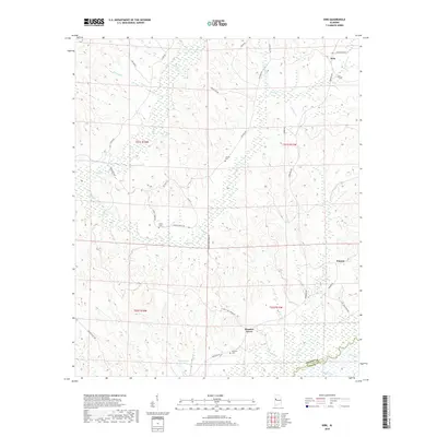
2018 Map of Kirk
USGS Topo · Published 2018About this map
Kirk and Pleasant Grove anchor this rural landscape in the western Alabama interior, where the topography is defined by the winding course of the Sipsey River as it crosses the Pickens Co Greene Co line. The settlement pattern is largely influenced by the drainage networks of Bear Cr and Sneads Cr, with small communities and family sites linked by a web of local roads such as Benevola Rd and Ray Bass Rd. For those tracing local heritage, several burial grounds are preserved across these hills, including Liberty Cem, Union Cem, and Mitchell Cem. The presence of landmarks like Lindsey Tower Rd and Longview Lake suggests a landscape shaped by both forest management and small-scale agriculture at the edge of the Sipsey basin.
Find a feature on this map
41 named features on this map. Tap any name to fly to it.
Don’t see what you’re looking for? This feature index may not catch every label — zoom into the map to look around manually.
Map Details
Editions of this 2018 Kirk Map
This is the sole edition of this map. No revisions or reprints were ever made.
Other maps of this area

1953 · Birmingham
USGS Topo · 1:250,000

1953 · West Point
USGS Topo · 1:250,000

1956 · Birmingham
USGS Topo · 1:250,000

1957 · Birmingham
USGS Topo · 1:250,000

1958 · West Point
USGS Topo · 1:250,000

1963 · West Point
USGS Topo · 1:250,000

1967 · Carrollton
USGS Topo · 1:24,000

1967 · Gordo
USGS Topo · 1:24,000

1967 · Elrod
USGS Topo · 1:24,000
1970 · Kirk
USGS Topo · 1:24,000