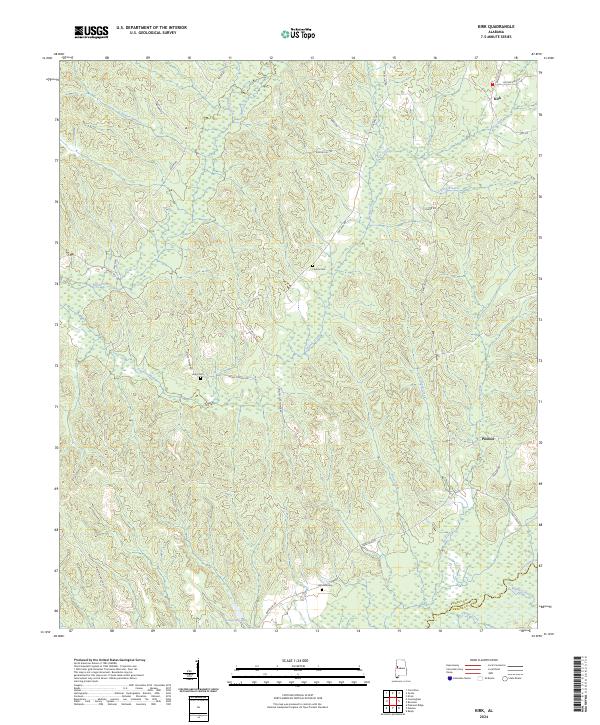
2024 Map of Kirk
USGS Topo · Published 2024About this map
The Sipsey River meanders across the southeastern corner of this landscape, marking the transition between Pickens and Greene counties. This modern topographic study reveals a quiet region defined by small settlements like Kirk and Pioneer, where the road network often follows the ridgelines between numerous drainages. Family and community heritage is evident in the placement of sites such as Liberty Cem, Union Cem, and Mitchell Cem, which serve as landmarks along rural routes like Benevola Rd and Union Church Rd.
Find a feature on this map
41 named features on this map. Tap any name to fly to it.
Don’t see what you’re looking for? This feature index may not catch every label — zoom into the map to look around manually.
Map Details
Editions of this 2024 Kirk Map
This is the sole edition of this map. No revisions or reprints were ever made.
Other maps of this area

1953 · Birmingham
USGS Topo · 1:250,000

1953 · West Point
USGS Topo · 1:250,000

1956 · Birmingham
USGS Topo · 1:250,000

1957 · Birmingham
USGS Topo · 1:250,000

1958 · West Point
USGS Topo · 1:250,000

1963 · West Point
USGS Topo · 1:250,000

1967 · Carrollton
USGS Topo · 1:24,000

1967 · Gordo
USGS Topo · 1:24,000

1967 · Elrod
USGS Topo · 1:24,000
1970 · Kirk
USGS Topo · 1:24,000