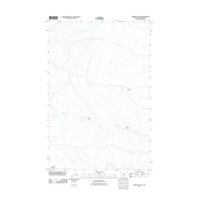
2011 Map of Kirkendal Flat
USGS Topo · Published 2011About this map
Kirkendal Flat anchors this high plains landscape within Petroleum County, where a complex network of seasonal drainage channels defines the topography. The area is characterized by deep coulees, such as Gordon Coulee and Kastner Coulee, which cut through the terrain to feed into larger water systems. Dovetail Creek winds across the central portion of the sheet, while Blood Creek and Swanson Coulee define the southern reaches. This 2011 survey illustrates the sparse, undeveloped character of this part of Montana, focusing on the natural hydrography of Drag Creek and its many unnamed tributaries. The map serves as a detailed record of the land's physical contours and its traditional ranching-country landmarks before more modern infrastructure or land-use changes.
Find a feature on this map
7 named features on this map. Tap any name to fly to it.
Don’t see what you’re looking for? This feature index may not catch every label — zoom into the map to look around manually.
Map Details
Editions of this 2011 Kirkendal Flat Map
This is the sole edition of this map. No revisions or reprints were ever made.
Other maps of this area

1954 · Jordan
USGS Topo · 1:250,000

1954 · Lewistown
USGS Topo · 1:250,000

1956 · Jordan
USGS Topo · 1:250,000

1958 · Jordan
USGS Topo · 1:250,000

1959 · Lewistown
USGS Topo · 1:250,000

1964 · Jordan
USGS Topo · 1:250,000

1965 · Germaine Coulee West
USGS Topo · 1:24,000
1965 · Weingart Place
USGS Topo · 1:24,000

1965 · Weingart Place NW
USGS Topo · 1:24,000

1967 · Nelson Coulee
USGS Topo · 1:24,000