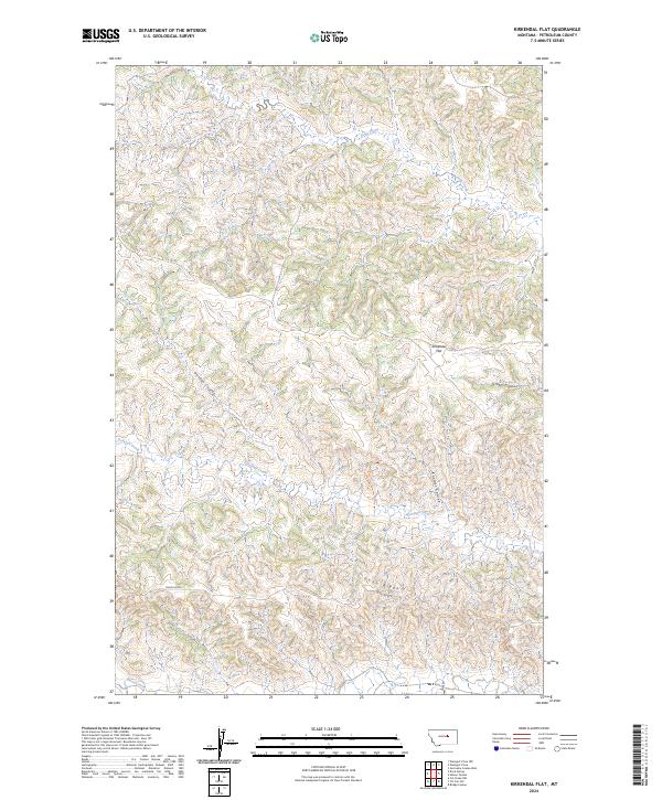
2024 Map of Kirkendal Flat
USGS Topo · Published 2024About this map
Kirkendal Flat sits at the heart of this Petroleum County landscape, where the high plains are deeply dissected by a network of drainage channels. The northern portion of the map is dominated by the Charles M Russell National Wildlife Refuge, indicating a preserved wilderness character that transitions into ranching and grazing lands to the south. The terrain is defined by its watercourses, including Dovetail Creek and several prominent coulees like Gordon Coulee and Kastner Coulee, which dictate the movement of local traffic and livestock. Human passage through this territory is marked by the 79 Trl and Dunn Ridge St, which follows the high ground along Dunn Ridge. This survey illustrates the intricate relationship between the sparse road network and the natural topography, where travel is often restricted to the ridges to avoid the steep breaks and coulees common in this part of Montana.
Find a feature on this map
18 named features on this map. Tap any name to fly to it.
Don’t see what you’re looking for? This feature index may not catch every label — zoom into the map to look around manually.
Map Details
Editions of this 2024 Kirkendal Flat Map
This is the sole edition of this map. No revisions or reprints were ever made.
Other maps of this area

1954 · Jordan
USGS Topo · 1:250,000

1954 · Lewistown
USGS Topo · 1:250,000

1956 · Jordan
USGS Topo · 1:250,000

1958 · Jordan
USGS Topo · 1:250,000

1959 · Lewistown
USGS Topo · 1:250,000

1964 · Jordan
USGS Topo · 1:250,000

1965 · Germaine Coulee West
USGS Topo · 1:24,000
1965 · Weingart Place
USGS Topo · 1:24,000

1965 · Weingart Place NW
USGS Topo · 1:24,000

1967 · Nelson Coulee
USGS Topo · 1:24,000