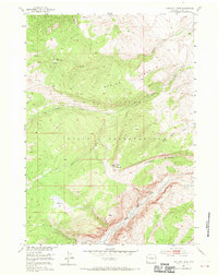
1952 Map of Kirkland Park
USGS Topo · Published 1970About this map
The Wind River Indian Reservation dominates this 1952 topographic study, showcasing the high-elevation terrain of Fremont County during the early post-war era. The landscape is defined by the significant hydrological divide between the North Fork Wind River and the South Fork Wind River, which carve deep drainage patterns across the sheet. At the heart of the area lies Kirkland Park, a distinctive high-altitude opening surrounded by prominent elevations including Crow Mountain and the expansive Spring Ridge.
Find a feature on this map
14 named features on this map. Tap any name to fly to it.
Don’t see what you’re looking for? This feature index may not catch every label — zoom into the map to look around manually.
Map Details
Editions of this 1952 Kirkland Park Map
3 editions found
Other maps of this area

1952 · Hays Park
USGS Topo · 1:24,000

1952 · Bob Lakes
USGS Topo · 1:24,000

1952 · Bull Lake West
USGS Topo · 1:24,000

1952 · Crowheart
USGS Topo · 1:24,000

1952 · Burris
USGS Topo · 1:24,000

1952 · Kirkland Park
USGS Topo · 1:24,000

1952 · Paradise Basin
USGS Topo · 1:24,000

1952 · St. Lawrence Basin
USGS Topo · 1:24,000

1952 · Alpine Lake
USGS Topo · 1:24,000

1955 · Thermopolis
USGS Topo · 1:250,000