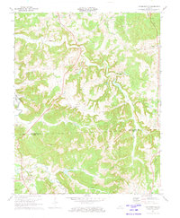
1972 Map of Kirkmansville
USGS Topo · Published 1973About this map
The Pond River forms the western boundary of this landscape, carving through the rural terrain of both Muhlenberg and Todd counties in the early 1970s. The settlement at Kirkmansville serves as a southern anchor, while Weir and Rosewood dot the northern and eastern reaches of the quadrangle. This area is defined by a dense network of watercourses, including Long Creek, Caney Creek, and Cow Creek, punctuated by numerous small dams like Dam No 9 and Dam No 2 that indicate active water management for the surrounding agricultural or industrial land.
Find a feature on this map
39 named features on this map. Tap any name to fly to it.
Don’t see what you’re looking for? This feature index may not catch every label — zoom into the map to look around manually.
Map Details
Editions of this 1972 Kirkmansville Map
2 editions found
Other maps of this area

1911 · Drakesboro
USGS Topo · 1:48,000

1912 · Nortonville
USGS Topo · 1:62,500

1913 · Drakesboro
USGS Topo · 1:62,500

1952 · Sharon Grove
USGS Topo · 1:24,000

1952 · Allegre
USGS Topo · 1:24,000

1952 · Honey Grove
USGS Topo · 1:24,000

1952 · Greenville
USGS Topo · 1:24,000

1953 · Drakesboro
USGS Topo · 1:24,000

1953 · Haleys Mill
USGS Topo · 1:24,000

1953 · Rosewood
USGS Topo · 1:24,000