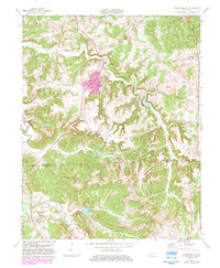
1972 Map of Kirkmansville
USGS Topo · Published 1983About this map
The Pond River and its intricate drainage network define the geography of the border between Muhlenberg and Todd counties. Settlement is concentrated along the ridges and highway corridors, with Kirkmansville serving as a primary local hub at the junction of routes 189 and 171. The landscape is a patchwork of agricultural land and wooded hills, where the rural economy in the early 1970s is clearly evidenced by numerous Oil Wells scattered across the northern half of the quadrangle, particularly near Weir.
Find a feature on this map
34 named features on this map. Tap any name to fly to it.
Don’t see what you’re looking for? This feature index may not catch every label — zoom into the map to look around manually.
Map Details
Editions of this 1972 Kirkmansville Map
2 editions found
Other maps of this area

1911 · Drakesboro
USGS Topo · 1:48,000

1912 · Nortonville
USGS Topo · 1:62,500

1913 · Drakesboro
USGS Topo · 1:62,500

1952 · Sharon Grove
USGS Topo · 1:24,000

1952 · Allegre
USGS Topo · 1:24,000

1952 · Honey Grove
USGS Topo · 1:24,000

1952 · Greenville
USGS Topo · 1:24,000

1953 · Drakesboro
USGS Topo · 1:24,000

1953 · Haleys Mill
USGS Topo · 1:24,000

1953 · Rosewood
USGS Topo · 1:24,000