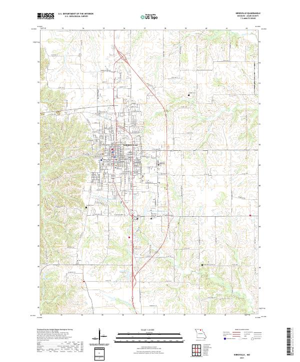
2021 Map of Kirksville
USGS Topo · Published 2021About this map
Kirksville serves as a prominent educational and civic hub in Adair County, defined by the extensive campuses of Truman State University and the A T Still University of Health Sciences. The city's downtown core is anchored by the Adair County Courthouse, while the surrounding neighborhoods are dotted with long-standing local landmarks including the Forest Llewellyn Cem and Maple Hill Cem. The transit geography is shaped by the BNSF Railway corridor cutting through the north, while the southern landscape transitions to more open terrain around Lake Vera and the E Fork Little Chariton River. This mapping reveals a mix of academic expansion and traditional rural roots, where family names are preserved at sites like Waddill Cem and Cater Cem. Water features such as Ownbey Lake and Kirksville Country Club Lake provide clear markers of local recreation and land use patterns.
Find a feature on this map
143 named features on this map. Tap any name to fly to it.
Don’t see what you’re looking for? This feature index may not catch every label — zoom into the map to look around manually.
Map Details
Editions of this 2021 Kirksville Map
This is the sole edition of this map. No revisions or reprints were ever made.
Other maps of this area

1903 · Edina
USGS Topo · 1:125,000

1911 · Queen City
USGS Topo · 1:62,500

1913 · Queen City
USGS Topo · 1:62,500

1938 · Kirksville
USGS Topo · 1:62,500

1940 · Kirksville
USGS Topo · 1:62,500

1954 · Centerville
USGS Topo · 1:250,000

1957 · Centerville
USGS Topo · 1:250,000

1958 · Centerville
USGS Topo · 1:250,000

1966 · Brashear
USGS Topo · 1:24,000
1966 · Willmathsville
USGS Topo · 1:24,000