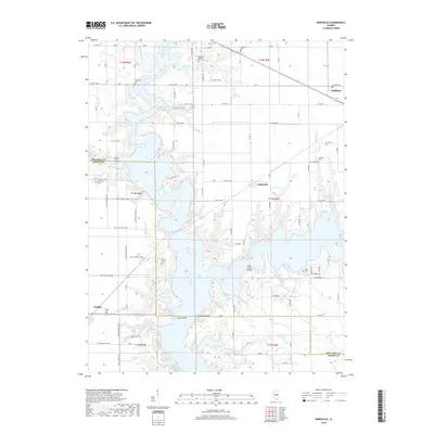
2018 Map of Kirksville
USGS Topo · Published 2018About this map
Lake Shelbyville dominates the central landscape of this central Illinois region, where the Moultrie Co Shelby Co line intersects the sprawling reservoir. The map reveals a transition from the structured agricultural grid of the surrounding prairies to the irregular, flooded inlets of the West Okaw River and Wolf Cr. The town of Findlay sits at the southwestern edge, while the smaller settlement of Kirksville remains positioned near the eastern shore, illustrating how the reservoir's creation reshaped local geography and road networks.
Find a feature on this map
49 named features on this map. Tap any name to fly to it.
Don’t see what you’re looking for? This feature index may not catch every label — zoom into the map to look around manually.
Map Details
Editions of this 2018 Kirksville Map
This is the sole edition of this map. No revisions or reprints were ever made.
Other maps of this area

1935 · Sullivan
USGS Topo · 1:48,000

1940 · Sullivan
USGS Topo · 1:62,500

1942 · Shelbyville
USGS Topo · 1:62,500

1946 · Shelbyville
USGS Topo · 1:62,500

1947 · Stewardson
USGS Topo · 1:62,500

1949 · Stewardson
USGS Topo · 1:62,500

1949 · Dalton City
USGS Topo · 1:62,500

1958 · Decatur
USGS Topo · 1:250,000

1961 · Decatur
USGS Topo · 1:250,000

1980 · Middlesworth
USGS Topo · 1:24,000