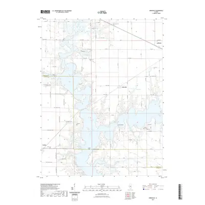
2021 Map of Kirksville
USGS Topo · Published 2021About this map
Lake Shelbyville dominates the central landscape of this central Illinois region, its expansive waters submerging the former paths of the West Okaw River and Wilborn Creek. The map documents a rural transition where the high-water line of the reservoir meets established agricultural grid roads like Co RD 1400n and Co RD 1100n. Genealogists will find a significant concentration of family burial grounds scattered across the terrain, including Hampton Cem near the northern border and the Carter - Ellis Cem overlooking the eastern shores.
Find a feature on this map
71 named features on this map. Tap any name to fly to it.
Don’t see what you’re looking for? This feature index may not catch every label — zoom into the map to look around manually.
Map Details
Editions of this 2021 Kirksville Map
This is the sole edition of this map. No revisions or reprints were ever made.
Other maps of this area

1935 · Sullivan
USGS Topo · 1:48,000

1940 · Sullivan
USGS Topo · 1:62,500

1942 · Shelbyville
USGS Topo · 1:62,500

1946 · Shelbyville
USGS Topo · 1:62,500

1947 · Stewardson
USGS Topo · 1:62,500

1949 · Stewardson
USGS Topo · 1:62,500

1949 · Dalton City
USGS Topo · 1:62,500

1958 · Decatur
USGS Topo · 1:250,000

1961 · Decatur
USGS Topo · 1:250,000

1980 · Middlesworth
USGS Topo · 1:24,000