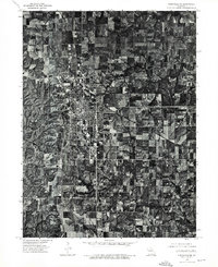
1974 Map of Kirksville NE
USGS Topo · Published 1976About this map
The growing city of Kirksville anchors this mid-1970s orthophotograph, providing a unique overhead perspective on the urban grid and the surrounding agricultural landscape of Adair County. Produced by the U.S. Geological Survey in cooperation with the Missouri Department of Natural Resources, the map uses rectified aerial imagery from April 1974 to show the precise expansion of residential neighborhoods and industrial areas. Unlike traditional topographic maps that use symbols, this orthophotograph reveals the actual density of forest cover, the orientation of individual farmsteads, and the specific footprint of the built environment. Researchers can trace the development of the road network and the relationship between the central city and the woodlots and fields that characterize the northern Missouri countryside during this era.
Find a feature on this map
1 named feature on this map. Tap any name to fly to it.
Don’t see what you’re looking for? This feature index may not catch every label — zoom into the map to look around manually.
Map Details
Editions of this 1974 Kirksville NE Map
This is the sole edition of this map. No revisions or reprints were ever made.
Other maps of this area

1903 · Edina
USGS Topo · 1:125,000

1911 · Queen City
USGS Topo · 1:62,500

1913 · Queen City
USGS Topo · 1:62,500

1938 · Kirksville
USGS Topo · 1:62,500

1940 · Kirksville
USGS Topo · 1:62,500

1954 · Centerville
USGS Topo · 1:250,000

1957 · Centerville
USGS Topo · 1:250,000

1958 · Centerville
USGS Topo · 1:250,000

1966 · Brashear
USGS Topo · 1:24,000
1966 · Willmathsville
USGS Topo · 1:24,000