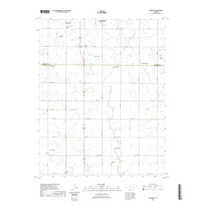
2018 Map of Kirkwood
USGS Topo · Published 2018About this map
Kirkwood and the southern outskirts of Pittsburg anchor this section of the Kansas landscape, where the border between Crawford and Cherokee counties bisects a region defined by agricultural plots and historical rural centers. The terrain is drained by a network of waterways including Cow Creek and its tributary E Cow Cr, alongside Brush Cr and Taylor Br. The map reveals a high concentration of community burial grounds, such as Crocker Cem, Bird Cem, and Lone Oak Cem, which often mark the sites of earlier population clusters. Settlements like Atlas, Kramer, and Langdon are linked by a grid of rural roads like NE Coal Valley Rd and NE Scammon Rd, reflecting a post-industrial landscape where coal-related place names persist even as the land has transitioned back to primary agricultural use.
Find a feature on this map
37 named features on this map. Tap any name to fly to it.
Don’t see what you’re looking for? This feature index may not catch every label — zoom into the map to look around manually.
Map Details
Editions of this 2018 Kirkwood Map
This is the sole edition of this map. No revisions or reprints were ever made.
Other maps of this area

1886 · Joplin
USGS Topo · 1:125,000

1894 · Joplin
USGS Topo · 1:125,000

1918 · Columbus
USGS Topo · 1:62,500

1943 · Cherokee
USGS Topo · 1:62,500

1945 · Pittsburg
USGS Topo · 1:62,500

1945 · Cherokee
USGS Topo · 1:62,500

1947 · Joplin
USGS Topo · 1:250,000

1947 · Pittsburg
USGS Topo · 1:62,500

1949 · Joplin
USGS Topo · 1:250,000

1950 · Pittsburg
USGS Topo · 1:62,500