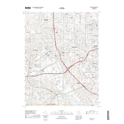
2017 Map of Kirkwood
USGS Topo · Published 2017About this map
Kirkwood and its surrounding suburban enclaves anchor this 2017 survey, revealing a landscape defined by dense residential development and established community landmarks in St Louis Co. The area is marked by numerous historic cemeteries, including Saint Pauls Cem in Des Peres and Oak Hill Cem near Oakland, which serve as vital touchstones for local genealogy. The southern portion of the map transitions toward the Meramec River valley, where the terrain becomes more varied around Fenton and Valley Park. Small, distinct neighborhoods such as Windsor Springs, Meacham Park, and Woodhine Heights are visible, alongside educational institutions like the Midwest Institute and the Saint Louis Coll of Health Careers. This map illustrates the 21st-century character of these Missouri communities, from the busy corridors of Manchester Rd to the quiet reaches of Grand Glaize Cr.
Find a feature on this map
213 named features on this map. Tap any name to fly to it.
Don’t see what you’re looking for? This feature index may not catch every label — zoom into the map to look around manually.
Map Details
Editions of this 2017 Kirkwood Map
This is the sole edition of this map. No revisions or reprints were ever made.
Other maps of this area

1901 · De Soto
USGS Topo · 1:125,000

1903 · O'Fallon
USGS Topo · 1:125,000

1912 · Kimmswick
USGS Topo · 1:62,500

1916 · Kimmswick
USGS Topo · 1:62,500

1931 · Manchester SE
USGS Topo · 1:24,000

1931 · Pacific NE
USGS Topo · 1:24,000

1932 · Manchester NE
USGS Topo · 1:24,000

1933 · Creve Coeur
USGS Topo · 1:24,000

1933 · Jefferson Barracks
USGS Topo · 1:24,000

1933 · Clayton
USGS Topo · 1:24,000