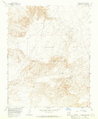
1966 Map of Kirtland SW
USGS Topo · Published 1969About this map
The high desert landscape of the Navajo Indian Reservation dominates this mid-1960s survey, illustrating a topography defined by erosion and resource extraction. The northern portion of the sheet is marked by the broad drainage of Chinde Wash, while the southern terrain is more deeply incised by the Cottonwood Arroyo. These ephemeral waterways were critical focal points for local land use, as seen at the Cottonwood Springs where a water tank was established to capture the flow in an otherwise arid environment.
Find a feature on this map
13 named features on this map. Tap any name to fly to it.
Don’t see what you’re looking for? This feature index may not catch every label — zoom into the map to look around manually.
Map Details
Editions of this 1966 Kirtland SW Map
2 editions found
Other maps of this area

1889 · Chaco
USGS Topo · 1:250,000

1892 · Chaco
USGS Topo · 1:250,000

1927 · Sulphur Spring
USGS Topo · 1:96,000

1928 · Kirtland
USGS Topo · 1:125,000

1932 · Kirtland
USGS Topo · 1:125,000

1954 · Shiprock
USGS Topo · 1:250,000

1958 · Shiprock
USGS Topo · 1:250,000

1959 · Shiprock
USGS Topo · 1:250,000
1966 · The Hogback North
USGS Topo · 1:24,000
1966 · Newcomb NE
USGS Topo · 1:24,000