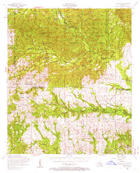
1954 Map of Kisatchie
USGS Topo · Published 1963About this map
Kisatchie National Forest dominates the upper half of this mid-century survey, where the rugged topography is defined by the winding course of Bayou Kisatchie and its numerous tributaries like Little Sandy Creek. In the central and southern portions, the landscape transitions from protected forest to the active training grounds of the Fort Polk Military Reservation, including the Peason Ridge Artillery Range.
Find a feature on this map
47 named features on this map. Tap any name to fly to it.
Don’t see what you’re looking for? This feature index may not catch every label — zoom into the map to look around manually.
Map Details
Editions of this 1954 Kisatchie Map
3 editions found
Other maps of this area

1937 · Chopin SW
USGS Topo · 1:31,680

1937 · Chopin NW
USGS Topo · 1:31,680

1937 · Bellwood
USGS Topo · 1:31,680

1937 · Montgomery
USGS Topo · 1:62,500

1937 · Cloutierville
USGS Topo · 1:31,680

1937 · Cypress
USGS Topo · 1:31,680

1941 · Leesville
USGS Topo · 1:62,500

1941 · Slagle
USGS Topo · 1:62,500

1942 · Many
USGS Topo · 1:62,500

1942 · Florien
USGS Topo · 1:62,500