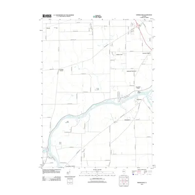
2012 Map of Kishwaukee
USGS Topo · Published 2012About this map
The Rock River and Kishwaukee River converge in this portion of Winnebago County, creating a landscape defined by waterway bends and riverside settlements. Small residential clusters and subdivisions like Woodcrest, Motor Heights, and Brewster Heights dot the area north of the river, while the community of Kishwaukee sits near the southern bank. For local historians, the map identifies several significant landmarks including Camp Medill McCormick and the Bishops Lane Retreat House, reflecting the region's role in recreation and organized retreats. Transportation and commerce are represented by Thrifty Acres Airport and the interestingly named Loose Pulley Junction near the southern boundary. Farmland and rural tracts are anchored by established sites like Pinehurst Farms and Winnebago Cem, illustrating a transition from agricultural roots to suburban expansion as the Rockford area grew.
Find a feature on this map
88 named features on this map. Tap any name to fly to it.
Don’t see what you’re looking for? This feature index may not catch every label — zoom into the map to look around manually.
Map Details
Editions of this 2012 Kishwaukee Map
This is the sole edition of this map. No revisions or reprints were ever made.
Other maps of this area

1917 · Kings
USGS Topo · 1:62,500

1918 · Rockford
USGS Topo · 1:62,500

1918 · Kings
USGS Topo · 1:62,500

1922 · Oregon
USGS Topo · 1:62,500

1924 · Oregon
USGS Topo · 1:62,500

1932 · Pecatonica
USGS Topo · 1:62,500

1936 · Pecatonica
USGS Topo · 1:62,500

1938 · Rockford
USGS Topo · 1:62,500

1949 · Camp Grant
USGS Topo · 1:24,000

1949 · Rockford
USGS Topo · 1:24,000