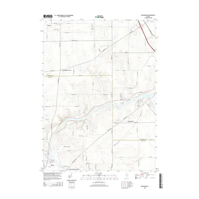
2015 Map of Kishwaukee
USGS Topo · Published 2015About this map
The Rock River carves a deep valley through this northern Illinois landscape, serving as the central geographical feature that connects the small settlements of Kishwaukee and Byron. The confluence with the Kishwaukee River highlights a traditional waterway junction that has influenced local transit for generations. To the north, agricultural patterns are interspersed with rural communities like Alworth and Westfield Corners, while family history is anchored at sites such as Winnebago Cem and Kishwaukee Cem. Aviation and industry intersect at Thrifty Acres Airport and the interestingly named Loose Pulley Junction near the southern boundary. This 2015 survey records the persistent rural character of the region even as modern road networks like S Meridian Rd provide primary north-south access across the county line.
Find a feature on this map
72 named features on this map. Tap any name to fly to it.
Don’t see what you’re looking for? This feature index may not catch every label — zoom into the map to look around manually.
Map Details
Editions of this 2015 Kishwaukee Map
This is the sole edition of this map. No revisions or reprints were ever made.
Other maps of this area

1917 · Kings
USGS Topo · 1:62,500

1918 · Rockford
USGS Topo · 1:62,500

1918 · Kings
USGS Topo · 1:62,500

1922 · Oregon
USGS Topo · 1:62,500

1924 · Oregon
USGS Topo · 1:62,500

1932 · Pecatonica
USGS Topo · 1:62,500

1936 · Pecatonica
USGS Topo · 1:62,500

1938 · Rockford
USGS Topo · 1:62,500

1949 · Camp Grant
USGS Topo · 1:24,000

1949 · Rockford
USGS Topo · 1:24,000