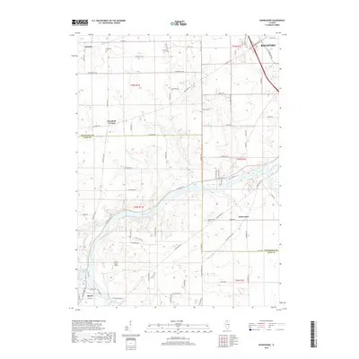
2018 Map of Kishwaukee
USGS Topo · Published 2018About this map
The Rock River winds prominently through this landscape, marking the transition between Winnebago Co and Ogle Co as it flows south toward Byron. This modern survey illustrates a corridor of rural development and agricultural patterns centered around the waterway. Smaller settlements and rural crossroads like Alworth, Westfield Corners, and Kishwaukee are situated among a dense grid of local roads, including Montague RD and N State Rte 2.
Find a feature on this map
43 named features on this map. Tap any name to fly to it.
Don’t see what you’re looking for? This feature index may not catch every label — zoom into the map to look around manually.
Map Details
Editions of this 2018 Kishwaukee Map
This is the sole edition of this map. No revisions or reprints were ever made.
Other maps of this area

1917 · Kings
USGS Topo · 1:62,500

1918 · Rockford
USGS Topo · 1:62,500

1918 · Kings
USGS Topo · 1:62,500

1922 · Oregon
USGS Topo · 1:62,500

1924 · Oregon
USGS Topo · 1:62,500

1932 · Pecatonica
USGS Topo · 1:62,500

1936 · Pecatonica
USGS Topo · 1:62,500

1938 · Rockford
USGS Topo · 1:62,500

1949 · Camp Grant
USGS Topo · 1:24,000

1949 · Rockford
USGS Topo · 1:24,000