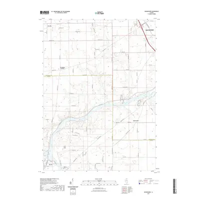
2021 Map of Kishwaukee
USGS Topo · Published 2021About this map
The Rock River winds through this northern Illinois landscape, defining the topography south of Rockford as it passes through Kishwaukee and toward Byron. This 2021 survey details a region where long-established rural settlements and modern aviation intersect, featuring the Thrifty Acres Airport and the distinct community of Westfield Corners. Local history and genealogy are anchored by several notable burial sites, including Winnebago Cem in the north and the Mouth of Stillman Cem near the southern boundary. The map provides a clear view of the transition from the structured street grid of the Rockford area to the sprawling agricultural tracts and residential developments of Winnebago Co and Ogle Co. In the southwest, the waters of Lake Louise sit just north of the Byron city limits, while the surrounding road network like S Meridian Rd and Stillman Valley Rd connects the scattered hamlets of Alworth and Kishwaukee.
Find a feature on this map
61 named features on this map. Tap any name to fly to it.
Don’t see what you’re looking for? This feature index may not catch every label — zoom into the map to look around manually.
Map Details
Editions of this 2021 Kishwaukee Map
This is the sole edition of this map. No revisions or reprints were ever made.
Other maps of this area

1917 · Kings
USGS Topo · 1:62,500

1918 · Rockford
USGS Topo · 1:62,500

1918 · Kings
USGS Topo · 1:62,500

1922 · Oregon
USGS Topo · 1:62,500

1924 · Oregon
USGS Topo · 1:62,500

1932 · Pecatonica
USGS Topo · 1:62,500

1936 · Pecatonica
USGS Topo · 1:62,500

1938 · Rockford
USGS Topo · 1:62,500

1949 · Camp Grant
USGS Topo · 1:24,000

1949 · Rockford
USGS Topo · 1:24,000