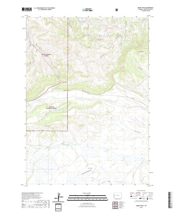
2021 Map of Kismet Peak
USGS Topo · Published 2021About this map
Teton National Forest and Bridger National Forest meet in this high-altitude landscape of Wyoming, where the terrain is defined by a dense network of mountain drainages and ridges. The map reveals a transition from the elevated peaks of Kismet Peak and Tripod Hill down toward the aviation infrastructure of Haas Airport in the south. Between these points, the land is carved by the Middle Beaver Cr and its various forks, along with numerous named draws and gulches such as Annie Draw and Cow Gulch. Access to this remote wilderness is marked by family-named and descriptive roads like Larsen Dr and Skyline Dr, reflecting a landscape primarily used for recreation, forestry, and limited rural residency. The presence of Fisherman Creek Rd and N Beaver Rd suggests established routes into the backcountry, serving as a modern reference for the drainage patterns of the South Rim.
Find a feature on this map
39 named features on this map. Tap any name to fly to it.
Don’t see what you’re looking for? This feature index may not catch every label — zoom into the map to look around manually.
Map Details
Editions of this 2021 Kismet Peak Map
This is the sole edition of this map. No revisions or reprints were ever made.
Other maps of this area

1907 · Gros Ventre
USGS Topo · 1:125,000

1910 · Gros Ventre
USGS Topo · 1:125,000

1939 · Big Piney
USGS Topo · 1:125,000

1942 · Big Piney
USGS Topo · 1:125,000

1955 · Driggs
USGS Topo · 1:250,000

1955 · Preston
USGS Topo · 1:250,000

1958 · Driggs
USGS Topo · 1:250,000

1958 · Preston
USGS Topo · 1:250,000

1962 · Driggs
USGS Topo · 1:250,000

1962 · Preston
USGS Topo · 1:250,000